N-ATLaS combines community reports, news feeds, and historical data to generate intelligent route safety scores with human-readable explanations.
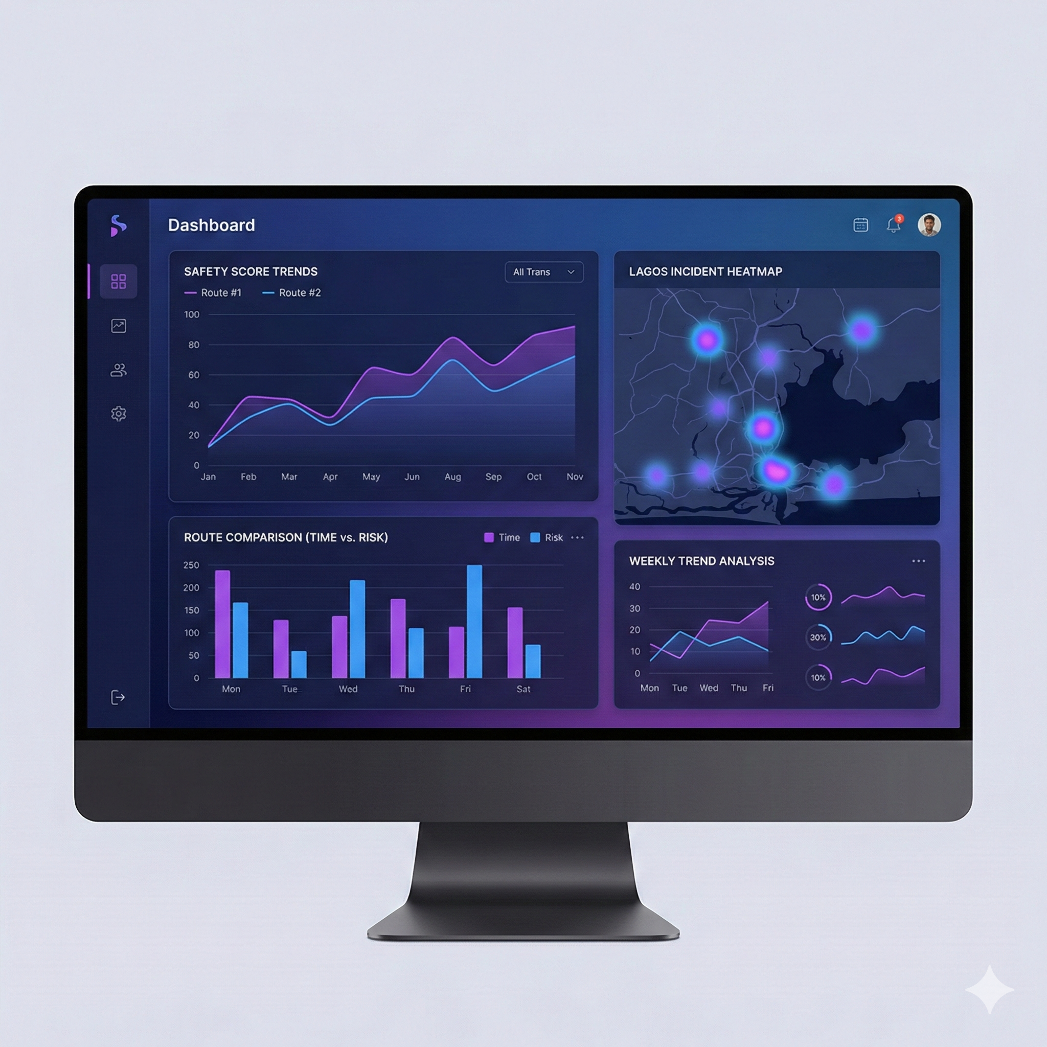
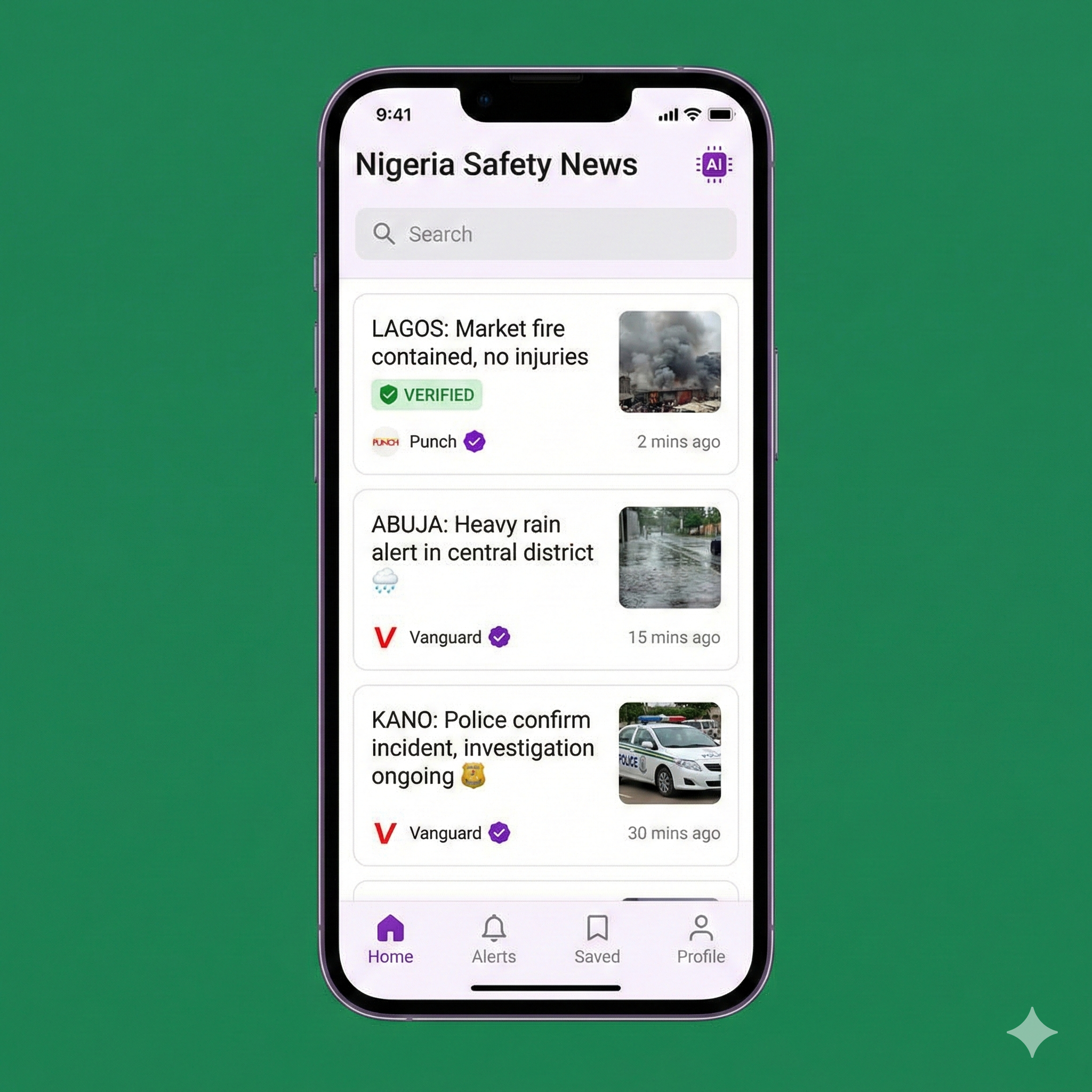
N-ATLaS (Navigation-Adaptive Threat Level Analysis System) is our advanced, self-hosted AI reasoning engine that processes thousands of data points to deliver real-time route safety intelligence.
Combines community reports, local news, historical incidents, and real-time updates
Generates human-readable reasons for safety scores, not just numbers
Analyzes and updates route safety as new information arrives
N-ATLaS analyzes diverse data streams for comprehensive safety intelligence
Users submit real-time incident reports with photos and videos. AI verifies authenticity and cross-references with other sources.
Real-time aggregation of safety-related news from Nigerian and regional media outlets, automatically categorized by location and severity.
Analysis of historical safety trends, time-of-day patterns, seasonal variations, and area-specific risk factors over time.
Comprehensive analytics dashboard provides deep insights into route safety patterns, incident trends, and geographic risk distribution across Nigeria.
Track how route safety changes over time and across different hours of the day
Real-time visualization of incident density across different Lagos areas
Side-by-side analysis of multiple route options comparing time vs. risk
AI-powered news aggregation pulls safety-relevant stories from multiple Nigerian media sources, verifies accuracy, and displays them with location context.
Verified sources with credibility scores
Real-time updates within minutes of publication
Automatic location tagging and route impact assessment
Advanced AI reasoning in 4 steps
N-ATLaS gathers community reports, news articles, and historical incident data for the specified route area
AI analyzes incident severity, recency, frequency, time patterns, and geographic clustering
Weighted algorithm generates numerical safety score (0-100) for each route segment
N-ATLaS generates written explanation: "This route has a safety score of 85. Lower risk due to no recent incidents. Minor traffic reported near junction."
Built for reliability, speed, and accuracy
N-ATLaS runs on our infrastructure for data privacy and control
Route safety updates within seconds of new data arrival
High-performance Python backend for AI inference
User location data encrypted and never shared
Download Route Guardian and see how N-ATLaS helps millions navigate Nigeria safely, backed by real-time intelligence.